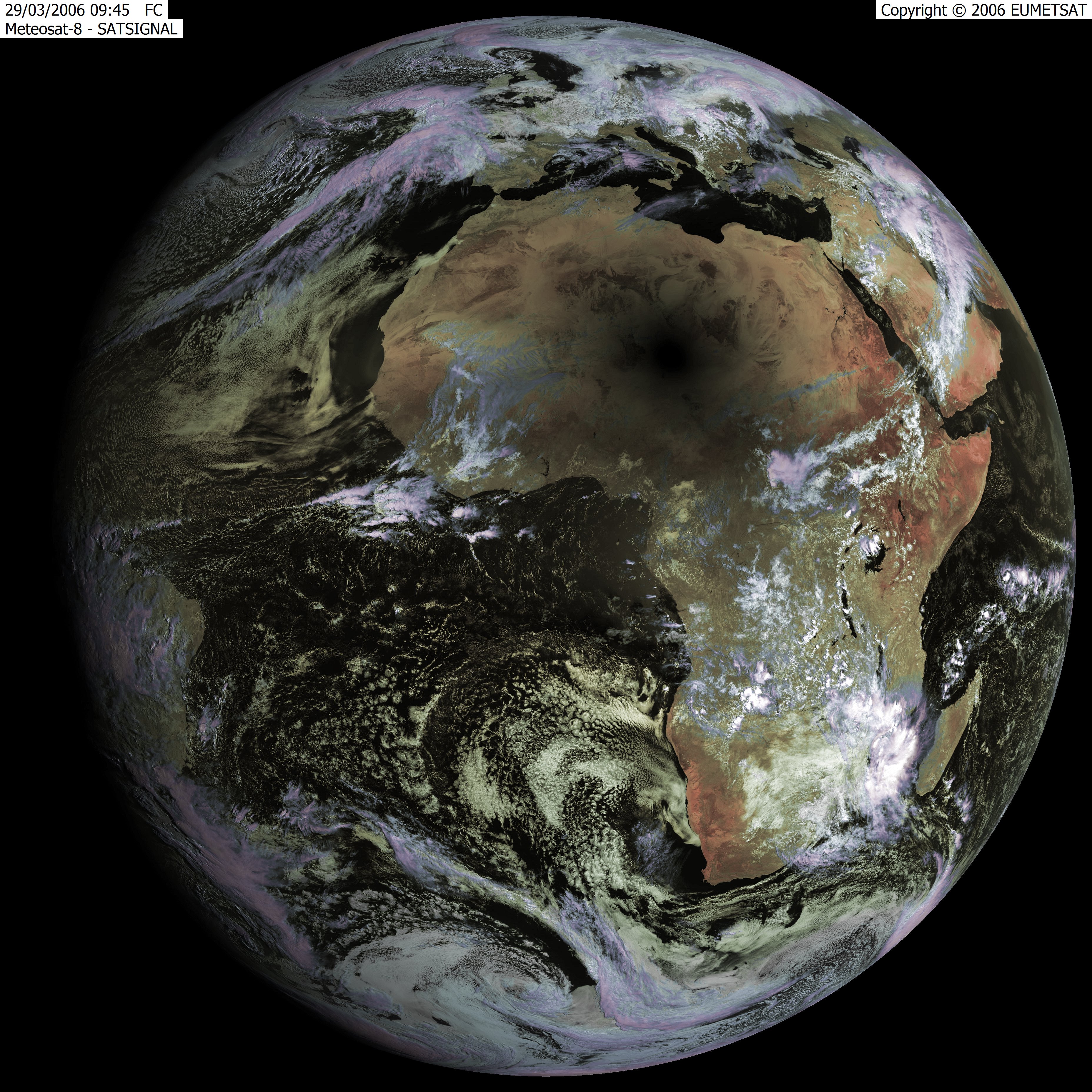
It is hard to imagine the scale of weather systems, which are essentially an integrated global phenomenon, when looking up at the sky and seeing the clouds roll past. It must be even harder to predict the complex set of ingredients; gravity, oceanic currents, minor differences in pressure, topography and surface cover. Whilst the above video shows some underlying pattern, any localised events at any moment in time appear surprisingly random. The satellite image below shows the solar eclipse (shadow in Central Sahara), but I find the snapshot of our atmosphere equally interesting. It is the most restless element of our planet, and in some ways the most powerful, able to bring about huge changes in a matter of years, weeks or even hours. At least we now understand the effects of the Gulf Stream and the South Pacific oscillations, and have some dreadful idea of the catastrophic events they might unleash when they wobble.
nurbn.today
N Some interesting maps of Tokyo using Satellite imagery and GPS. I found the maps of the water networks particularly impressive. Water distribution works via pressure, and closely resembles the road layout, sewage however works by gravity, and sticks to the topography.

Keine Kommentare:
Kommentar veröffentlichen